What is the Dirt Bag Rally?

The Dirt Bag Rally was started in the summer of 2014. Actually it's an adaptation of the Dirt Bag Yacht Club which was originally started around 1988 as a way for us to go boating together. Now we're exploring and adventuring on the land. Unfortunately we are separated by a continent - one on the east coast and me on the west coast. So we try to meet somewhere's for a few days to share laughs, stories, experiences, and adventures.

The blog will post stories about trips, preparations, camping gear and items, food, and much, much more.

Friday, March 27, 2015

Preparing For An Epic Trip

Now that the epic trip is planned, it's time to set up a schedule of activities and things to do leading up to the trip. I've learned after many trouble free summers of remote boating up the Inside Passage that preparation was key to having many safe and successful trips. Sure I am motorcycling  rather than boating but proper preparation is still important. Here's a schedule that I try to adhere to.

Three to six months out from the trip.
  1. Revisit the route plan. I'll take a fresh look at the route from time to time, especially the daily mileages planned and ask, "Is this realistic?" I've found that the first two days after you leave home some serious miles can be achieved, but as the days go on there's no way to maintain those high mileage long days. Rather I plan to ride less miles and maybe plan for a day off from riding to keep it from being an endurance ride.
  2. Check out your ride. Does my motorcycle need any maintenance or fixing? Oh my the thought of being stuck on the road for repairs gives me the creeps. As a precaution I'll go through my maintenance log and review my recent maintenance activity such as tune ups, oil changes, etc. and see if I need to schedule any maintenance or repairs well prior to the trip. I'll check my tires for wear and ask, "Will they make the trip?"
  3. Adding any accessories? Such as, luggage racks, bags, highway pegs, or lights to my ride? If so now's the time for me to add them. I do this early so I can get used to riding with any modifications. Last year I added a luggage shelf that fit over the pillion seat. Glad I ordered it early because it was on back order for almost two months. Then I mounted it and went for several rides making sure it did not affect my riding. It worked out great.
  4. Start an early list of essential camping gear. Such as tent, sleeping bag, stove, cook kit, etc. I'm glad about motorcycling because the list of essentials is so much shorter and cheaper than boating. I will set up my tent, fire up the stove, and other gear to check it all out. I ask myself, "Do parts need replacing?" "Does it work as expected?", "Do I need to replace it?" I will make a list of accessory or "nice to have" things such as spare wicks, batteries, tent stakes, repair kit, etc. Then slowly stock up on these items.
  5. Start exercising for the trip. It is important to build up endurance and the muscle needed to safely and successfully do the trip. Muscles and endurance are not gained a few days before the trip. This means going to the gym and exercising muscles such as neck, back and abdominal muscles for sitting long hours on my motorcycle; arms and shoulders for riding; and calves and thighs for standing. Being fit will keep you from being so tired after a day of riding.
  6. Making the necessary reservations at popular spots. I found that at some parks like Mesa Verde National Park, tours to the ruins are limited and require tickets to attend. Get those tickets or reservations in early rather than when you arrive and find that they're full. Last year I reserved our many campsites early so when on the trip we never had to worry whether we would find a spot or not.
One to two months out from the trip.
  1. Create a packing list. Include clothes, camping gear (more detailed list), electronics (cell phone,
    camera, batteries, cables, etc.) riding gear, and tools/emergency stuff. I ask myself, "Do I need this?", "Is this absolutely essential to have?" Don't be afraid to add things or subtract things from this list. Last year I modified the list several times and believe I had all the right stuff with me. If traveling with a partner check their list too. This might save you from having to bring something.
  2. Practice riding a few long distance rides. I'll include one or two overnight trips so I can test my camping gear and practice my routine of setting up camp and tearing it down. I found out last year that my arms needed more strength. Luckily I found out early enough to go to the gym. Sure enough when the big trip came my arms weren't tired.
  3. Get all necessary paperwork in order. Such as phone numbers, registrations and licensing, permits, credit/debit cards (renewals), etc. Last year I found that my debit card had expired on my trip. It was a pain to get my new one forwarded to me. Also, this year I acquired an "America The Beautiful" annual pass for visiting the many national parks and monuments. 
  4. Check in with other friends or riders that might be joining you. Don't assume they're at the same preparation you are. Ask them, "Are they still up for the trip?" It's good to stay in touch. It had the benefit of me making some beneficial gear changes prior to the start of the trip. 
Less than one month out from the trip.

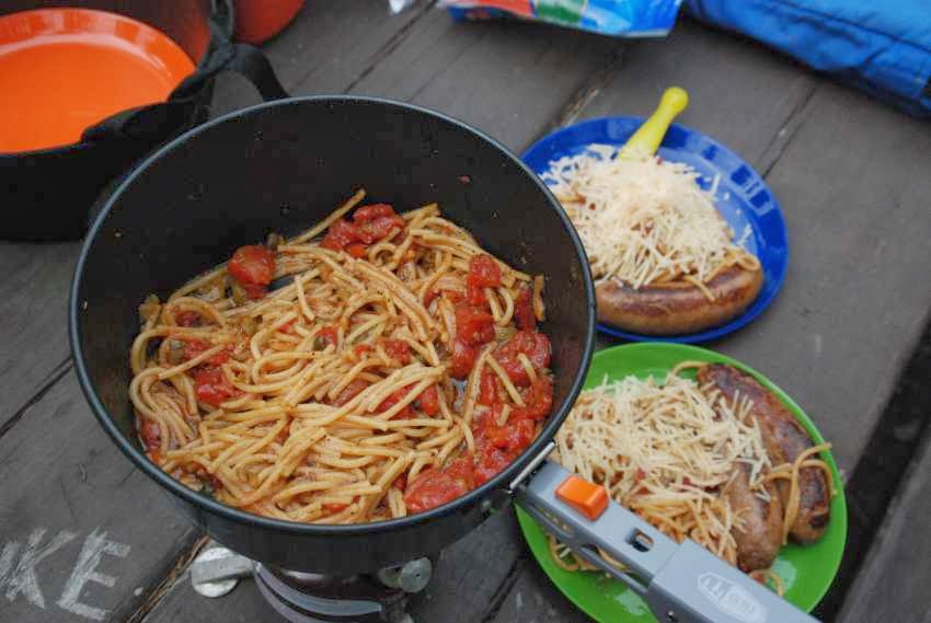
  1. Make a food/snack list and/or menu. I will be camping so I will develop a menu for the meals I will be preparing. I will bring one or more Zip Lock bags with spice ingredients. The other needed ingredients are written on the bag. Last year this turned out to be great. Instead of stopping and wondering what we were going to make, we stopped and got the ingredients and prepared many delicious suppers.
  2. Practice packing the bike and test driving it. Develop a packing plan that evenly distributes the weight and so you know where things are at. Nothing worse than trying to remember where you packed something and having to dig everything out to find it. I'm not afraid to revise my packing list to add or subtract things. When I pack my bike do I look like a vagabond junk salesman with things hanging here and there, or is my bike packed neatly, securely, streamlined, and weather proof? It is also important that weight is distributed evenly. On a trip last year I found that I had to repack everything because one side of the bike was heavier than the other. This uneven weight caused me to drift to one side of the road.
  3. Go online and check out the various state Dept. of Transportation websites for road construction. Do I need to change my route? Last year I found out that over a 100 mile road construction project in Montana was warning motorcyclists caution and if possible avoid the construction. Luckily I changed my route. Later I talked to another motorcyclist who rode through the construction and complained how tough it was and how long it took.
  4. Familiarize yourself with the trip itinerary. Commit some of it to memory. Sure the route is on the GPS but knowing what to expect each day was fun and helped us make the most of it. Last year I had my GoPro camera ready when we went through Custer State Park in South Dakota and saw the herd of buffalo.
  5. Download routes to GPS. And, test to see if they are successfully loaded before leaving.
  6. Send a printed copy to a friend or family member. It is important that family and friends know how to reach you in case of an emergency.
  7. Review your cost spreadsheet. Make sure you have the funds to do your trip and get cash to have on hand.
I've found that a properly planned and prepared trip has a great chance for success and fun.

Friday, March 20, 2015

Helpful Smartphone Travel Apps To Have

My smartphone is much more than a phone when I'm traveling. It is my portable digital travel assistant. By using various apps on my smartphone I can easily get road condition information, lodging choices, gas prices, best places to eat, information about parks, weather, wind, directions and more. As a result it is an essential component of my travel gear.

These are what I consider as "must have" travel apps. These apps can make your trip safer and more enjoyable.  These are all for an Android smartphone and all available for downloading from Google Play. If there is an Apple iPhone version it's listed. If not, there's plenty of similar substitutes that you can search for. Of course the list doesn't include standard apps such as camera, browser and other apps. You probably have your own favorite apps to add to this list. If you know of an app that you consider helpful tell me and others about it by leaving a comment.

The below list is not in priority order.

The Weather Channel appThe Weather Channel. Provides current weather conditions  (temperature, barometric pressure, visibility, humidity, sunrise and sunset) based on your location, hourly forecast (temperature, precipitation chance, and expected wind speed), extended forecast, and weather radar. Helpful in avoiding rain and storms. Free. IOS available.

Wind AlertWind Alert. Shows current wind speed and direction for your current location and over a large geographical area. Helpful in finding dust and wind storms. Nothing worse than driving or camping in strong winds. Free. IOS available.

Gas Buddy. Shows current gas prices, gas station address, map, distance to, and amenities found at the station (times open, ATM, restrooms, food, groceries, etc.). When out of town the app has a convenient "Find Gas Near Me" button. When traveling in remote locations gas stations may unexpectedly close. Free. IOS available.


WSDOT. Information on Washington State road conditions (traffic, alerts, pass information, ferries, and border wait times). Other states have similar apps such as ID 511 for Idaho. Free. IOS available.


Google Maps. Map of current location, directions. Can add layers of traffic and Google Earth. Free.


GPS Status. Displays latitude and longitude of current location, speed, direction (compass) and elevation. Helpful when in remote locations and you might need to tell someone exactly where you are at. Free.

My Tracks. This app records your travel as you go so you can see where you have been. You can easily add pictures and annotations to points in your route. Great app if you're going off road or hiking. Free.

Allstays. A "full service" app that lists campgrounds, RV repairs, and fuel stops. Amenities per site are listed as well as address and contact information. Directions to sites are available. A nice map app shows the sites. Lists private and public campgrounds. App costs $9.99. IOS available.

Trimble Pro Navigator. If you trip involves using gravel roads or hiking this app allows you to download topo maps and use them later when there's no cell service or wifi. You can mark or record your route, make annotations and add pics. USFS topo maps can be downloaded for free from USGS website. Other maps are available for a nominal fee. App costs $4.99. IOS available.

Pocket Ranger. Shows information about Washington State Parks (amenities, alerts, park maps, campground availability, and more.). Can make campsite reservations. Many other states have similar Pocket Ranger apps. Free. IOS available.


Puget Sound Fresh. Information on public markets, farms, currently available fruits and vegetables, farm products, and events for Washington, particularly Puget Sound area. Has a map mode so you can see what's near you. Many other states have similar apps. Great app if you are into farm fresh foods. Free. IOS available.

TripAdvisor. Get information on lodging, restaurants and attractions (cost, location/address, member reviews). Can make lodging reservations right from app. Has a handy "Near Me Now" button to find lodging, restaurants, and things to do. I prefer this over the similar app Yelp because it has lodging and "things to do" information. Free. IOS available.

AAA. If you have AAA this app provides you quick access to emergency and member services. You can also use the app to find out about variou discounts and reserve lodging. Free but requires AAA membership. IOS available.

FillUp. Records fuel purchases and gives you miles per gallon information. The statistics are helpful in estimating fuel costs and how far you can go between gas fill ups. You can enter data for multiple vehicles. Free.

B-Folders. Secure important personal information (insurance, vehicle info, credit/debit cards, medications, etc.). If you lose your wallet you will still have essential information as well as important phone numbers. Data on your phone is encrypted if your phone is lost or stolen. Free.

ColorNote. Helpful notepadd app. Can choose various colors for different notes. Can easily email note. Free

ConvertPad. Convenient when needing to convert kilometers into miles or other conversions such as temperature or weight. Free.


Stopwatch & Timer. Handy to have a stopwatch or timer. Free.


List Master. Create to do or packing lists. Free.

Tuesday, March 17, 2015

Planning An Epic Trip

Planning an epic road trip takes time, a lot of time. It's a "cascading" process.  Here are the steps I use.

1. Get a grand scale idea.
First look at a national map to get an idea of areas to visit and get a grand scale of the trip. Next look at the individual state maps for greater detail. Ask, "Where is it that you want to go?" "What is it that you want to see or experience?" America is big. Start to recognize the size of your "epic trip."

Once, the destination(s) is/are determined, now figure out how to get there. The easy way is to look at a map and take the Interstate freeways and US Highways.Unfortunately these freeways and highways often miss the grandeur and beauty of what America is. To get up close and personal to travel America I prefer to take the various state highways, county roads and US Forest Service (USFS) roads. Often times these roads are not visible within the road maps within a Road Atlas. To do this you need to use a GPS and mapping software.

2. Use GPS mapping software.
Garmin BaseCamp software
I use a Garmin GPS (Zumo 660) and Garmin's BaseCamp software to identify a route and then download it into my GPS. The route is made up of many waypoints. A waypoint is a specific geographical location on a map.
Multiple waypoints are then connected by roads. The minimal waypoints are the starting and ending locations. The GPS will figure out the route in between your start and finish depending on how it is configured - shortest route or fastest route.  As a result the route determined by the GPS may not be the route desired. The fastest route is not the shortest route since the GPS will make will select the fastest roads, e.g., interstate freeways and highways. The shortest route is not the fastest route, rather it is the most direct between two waypoints even if they are residential streets or dirt roads. Fortunately many GPS devices can be configured to avoid many different roads such as, residential streets, dirt roads, freeways, toll roads, ferry routes and more depending on your GPS. To get a route which is desirable many "intermediate waypoints" will need to be entered. By entering intermediate waypoints the GPS will be forced to determine a route closer to what is desired. Finding and identifying these intermediate waypoints takes time, research and patience.

Waypoint List
Click on image to enlarge
3. Determine "Intermediate Waypoints" to get the route you want.
Intermediate waypoints may be intersections, restaurants, museums, scenic overlooks, rest areas, parks, gas stations or whatever. Some GPS devices have in their internal database a wide variety of sites that can be used as intermediate waypoints.  If you are like me, I continue to do more online research about interesting places and enter these locations as intermediate waypoints. Finally after many hours of effort the "best" route, as determined by you and the GPS, will be achieved through the intermediate waypoints entered.

4. Anticipate problems.
Experience has taught me that while I believe I have the best route, circumstances such as road construction or events may have undesirable consequences on my trip. I then visit each states' Department of Transportation (DOT) or USFS website looking for construction projects or road closures. Some state DOTs even have smartphone apps like "511" that inform you of current road conditions. If the construction or event is serious enough I may need to alter my route yet again. Last summer I found a 100 mile road construction project in Montana that advised caution or avoidance by motorcycles - I changed my route.

5. Understand the time and money needed.
Once I have the route determined, I need to understand how much is this all going to cost - food, lodging, fuel, extras, etc.?  I want to know how much time I will need to do the entire trip, and how many miles per day I need to travel? To do this I build a spreadsheet which lists, waypoints, miles between waypoints, average expected speed, mpg, dates and time getting started each day. I enter formulas that calculate the amount of time it will take between waypoints and the time needed each day. Another formula calculates when and how much gas I'll need based on my motorcycle's mpg. Based on that I may need to add a gas station waypoint. I then use the "Gas Buddy" app on my smartphone to verify they are open and get an idea on gas cost. I then enter the estimated costs associated with each stop (e.g., Starbucks Coffee stop, gas, lunch, etc.) and how much time I expect to be there to help me plan each day. I may find that I need to separate my planned route into several days each with its own start and an end. Driving 800 miles and stopping at many scenic sites in one day is impossible or grueling.
Trip Plan spreadsheet
Click on image to enlarge
6. Know your overnight stops.
The last step is to confirm your overnight stops. I have found that assuming there'll be a vacancy at your motel or campground may not always be realistic. Other rallies, conventions, family reunions, or whatever may fill up your overnight plans leaving you with more miles to drive with more unanswered expectations. I have found that when camping I try to get to the campground - if they don't take reservations - by 2:00 or 3:00 PM. After that time the risk of the campground being full increases especially during peak summer travel season. Again, you may need to change your route (e.g., shorter day) to accommodate overnight lodging plans. There are lots a different camping and motel apps that can provide you with details, costs, and most importantly desired availability.

7. Be realistic with your trip expectations.
By taking your GPS route and comparing it to a spreadsheet along with apps and online research the planned trip really begins to come together. Often times some scenic destinations need to be dropped from your itinerary because there isn't enough time. As a good friend says, "You can't see it all." Perhaps a whole day needs to be added or deleted. Or, a different route needs to be determined. Remember a rushed or overloaded trip is no fun. Be realistic..

8. Talk it over with your fellow travelers - get buy off on your plans.
Don't forget to share your route and spreadsheet with fellow travelers so they can understand the trip too. They may have suggestions that once again cause changes to the trip. The end result is an epic trip that is clearly understood, affordable, enjoyable, and doable.
BaseCamp route

If you would like a copy of my trip planning spreadsheet to modify and use for your own trips, and/or a list of smartphone apps and helpful websites used for planning a trip, please leave a comment on this post. I'll email it to you.

Saturday, March 14, 2015

2015 DBRII Route

2015 DBRII Route
Click on map for larger image
2015 DBRII Details
Day 0. 0 miles. Fort Collins Motel 6*. Start of DBR II
Day 1. 231 miles. USFS Molly Brown campground, Leadville, CO
     - Rocky Mt NP, US 34 - Trail Ridge Rd - highest continuously paved road in US, highest point of DBRII 12,183 ft!
     - Fall River Pass, 11796', Rocky Mt NP, US 34
     - Milner Pass, 10758', Rocky Mt NP, US 34
     - Berthoud Pass, 11315', Arapaho NF, US 40
     - Loveland Pass, 11990', Arapaho NF, US 6, alternative route Eisenhower tunnel I 70
     - Alpine slide in Winter Park, CO
     - Fremont Pass,11318', White River NF, CO 91
Day 2.  245 miles. South Rim campground, Black Canyon of the Gunnison NP, CO
   .- Independence Pass, 12093', White River NF, CO 82
    - Independence ghost town (self-guided walking tour)
    - Aspen
    - McClure Pass, 8753', Grand Mesa NF, CO 133    
    - Black Canyon of the Gunnison NP
      - Drive South Rim Rd to view the canyon, stopping & walking to various viewpoints. 
      - East Portal Rd. "...road is extremely steep (16% grades) with hairpin curves."
Day 3. 159 mi. Morefield campground, Mesa Verde NP, CO
    - Million Dollar Hwy, US 550
    - Red Mtn Pass, 11018', San Juan NF, US 550
    - Molas Pass, 10910', San Juan NF, US 550
    - Coal Bank Pass, 10640', San Juan NF, US 550
    - Durango 
    - Mesa Verde NP
      - Mesa Verde Cliff Palace Photography Tour.
      - Morefield campground evening program
Day 4. 281 mi. Thousand Lakes RV Park, Torrey, UT
    - Ismay Trading Post
    - Hovenweep Square Tower NM - short walk;
    - Natural Bridges NM - short walk,
    - Capitol Reef NP (pick fruit at Fruita site?) - scenic drive with stops
Day 5. 217 mi. Bryan Head, UT
    - Escalante NM - stops along the way.
    - Kodachrome SP - side trip & scenic drive
    - Bryce Canyon NP - scenic drive with stops
Day 6. 183 mi. Bryan Head, UT 
   - Zion NP - Narrows hike (5 mi round trip)
   - Cedar Breaks NM,
Day 7. End of DBR II
Total: 2,743 miles